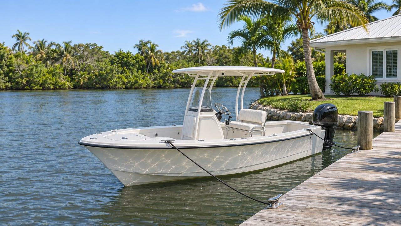
On the St. Lucie River, the waterfront homes and slips around Stuart split into two groups at one point: the Florida East Coast railroad bridge at Okeechobee Waterway mile 7.41, next to downtown Stuart. When it is down, it clears about 6 feet at mean high water. A boat kept downriver of it can reach the St. Lucie Inlet without passing it. A boat kept upriver goes under it twice on every ocean trip.
Median prices on a listing portal don't show which side of that bridge a home is on, but a boat owner feels it every weekend. A replacement bridge was funded this past August, and it changes the math for most boats. It does less for boats that stand taller than 14 feet, because a second, older drawbridge right next to the railroad bridge stays where it is.
Three bridges, two drawbridges
Three bridges cross the river side by side at downtown Stuart. The U.S. 1 Roosevelt Bridge is a fixed span with 65 feet of clearance, so nearly every recreational boat passes under it without slowing. The other two are drawbridges. The FEC railroad bridge clears 6 feet when closed. The SR 707 Dixie Highway drawbridge at mile 7.5 clears 14 feet when closed, according to the U.S. Coast Guard. Older chart text sometimes calls the 14-foot span a "Roosevelt" bridge. It is the Dixie Highway bridge, not the high U.S. 1 bridge.
Which neighborhoods sit on which side
The Okeechobee Waterway is numbered from Mile 0.0 at the Intracoastal junction in the St. Lucie Inlet, and the numbers rise as you head west. Any marker above 7.41 is upriver of the railroad bridge.
| Place | Where it sits | Side of the rail bridge |
|---|---|---|
| Manatee Pocket and Port Salerno | 0.6 mile west of the river and ICW junction; Port Salerno at the head of the pocket | Downriver |
| Hinckley Yacht Services, Pirate's Cove Resort & Marina | Manatee Pocket | Downriver |
| Port Sewall | 1.2 miles above the junction | Downriver |
| Rio | North bank, 3.5 miles above Sewall Point | Downriver |
| Sunset Bay Marina & Anchorage | Mile 8.0, downtown Stuart | Upriver |
| South Fork | Begins at mile 7.7 | Upriver |
| Palm City | Mile 9.5, west bank of the South Fork | Upriver |
| Riverwatch Marina | Mile 9.6 | Upriver |
| North Fork, including North River Shores | Runs north-northwest from the fork west of Stuart | Upriver |
Downtown Stuart's marina is on the upriver side. Sunset Bay is at mile 8.0, above the railroad bridge, so boats kept there go through the same bridge cluster as boats kept in Palm City. The Palm City bridge at mile 9.5 is a fixed span with 54 feet of clearance, so for most South Fork homes the downtown cluster is the only drawbridge between the dock and the inlet. Harbour Ridge, the Palm City club community on the river, runs a 98-slip marina for boats from 24 to 80 feet, and that whole fleet reaches open water through the same bridges.
What a day on the water above the bridge looks like now
The railroad span comes down for trains on a corridor that carries both Brightline passenger service and Florida East Coast Railway freight. The Coast Guard had an independent contractor count boat traffic at the bridge from November 1, 2023, through April 7, 2024. In the 110 days of usable data, it recorded 16,406 vessel passages between 6 a.m. and 8 p.m. In that period, 5,325 vessels waited for the span to open, and the average wait was 20.2 minutes. Traffic was heaviest Friday through Sunday, between 9 a.m. and 4 p.m.
Those figures work out to about one waiting boat for every three that passed, with a typical wait close to a third of an hour. In 2022, before that count, public comments to the Coast Guard described waits of 45 to 60 minutes after trains had cleared.
So a home above the bridge comes with a bridge crossing on every ocean trip. Twenty minutes is easy to plan around. It matters most for buyers who expect to run to the inlet several times a week.
The replacement fixes the low point for most boats
On August 18, 2026, the U.S. Department of Transportation awarded the City of Stuart $78.9 million to replace the 100-year-old railroad bridge with a double-track structure, according to Brightline's announcement. The full project is estimated at $262 million. The new grant joins a $130 million USDOT grant committed in 2023, so about $209 million of the cost now has federal money behind it.
The design numbers are the part a boat owner should care about. Horizontal clearance goes from 50 feet to about 90 feet. Vertical clearance in the closed position goes from 6.5 feet to about 17.75 feet at mean high water. The release says that would let more than 90 percent of vessels pass with the bridge down. Congressman Brian Mast is quoted in the release calling the current bridge "a daily headache for boaters."
When WPTV covered the grant in August, construction timing was still to come. A buyer who closes on an upriver home this winter will use today's 6-foot bridge for some time. The replacement is a reason for a longer hold, not for next season's boating.
The 14-foot bridge sets the limit for taller boats
Once the new railroad bridge is built, the cluster's lowest closed clearance will no longer be the 6-foot railroad span. It will be the Dixie Highway drawbridge at 14 feet, which the railroad grant does not touch. A boat that fits under 14 feet with its top up would pass both drawbridges while they are down, and the wait would stop affecting that owner's day. A boat that stands taller than 14 feet would still need the Dixie Highway bridge to open.
That's why the replacement helps different upriver buyers by different amounts. The 2023–24 Coast Guard study found that 99 percent of passing vessels were between 6 and 16 feet, sizes it described as typically recreational. For a Palm City or North Fork buyer with a boat that fits under the new span, the replacement removes most of the waiting. For a taller boat, the number to compare against is 14 feet, not the 17.75-foot figure in the announcements.
How the medians compare across the bridge
In the third quarter of 2026, the median single-family sale price was $650,000 in Palm City, $649,500 in the City of Stuart and $576,000 in Port Salerno, according to the Florida Realtors' municipal report released October 16, 2026. Sewall's Point, downriver near the inlet, had a third-quarter median of $2,200,000.
Palm City, upriver, and Port Salerno, downriver on Manatee Pocket, sat within about $75,000 of each other last quarter. Their medians are close, but their access to the inlet is very different. Those medians include inland homes too, so a buyer comparing a South Fork dock with a Manatee Pocket dock has to weigh the bridge separately. The replacement is the one change in sight that could narrow the gap, and only for boats under the 14-foot line.
About the downtown station
Brightline trains also feed into a separate downtown question. Martin County has proposed a Brightline passenger station at 500 SE Flagler Avenue, across from the courthouse. In May, WPTV reported that the Florida East Coast Railway opposed the station because a train stopped there would keep the river bridge down. Brightline disputed that view. In August, WFLX reported that the station did not receive the federal grant that went to the bridge. The station is still a proposal, and the bridge is where the money has gone.
Quick answers
Is downtown Stuart upriver or downriver of the railroad bridge? Sunset Bay Marina, at mile 8.0, is upriver, so boats kept at the downtown marina pass the railroad bridge on the way to the inlet.
Does a Palm City home have any other drawbridge between the dock and the inlet? The Palm City bridge on the South Fork is a fixed span with 54 feet of clearance, so for most boats the downtown drawbridges are the ones that matter.
If you're choosing between a South Fork dock and a Manatee Pocket slip, measure the boat you own or plan to buy before you compare the homes. Then bring those measurements to Renny Realty, and we'll go through the waterfront homes you're weighing in Stuart and Port Salerno with the bridge in mind. Schedule a Consultation.